blah blah blah
Neville Peak
Length: 3.2 miles out-and-back with loopDifficulty (click for info): Easy
Elevation Gain: 610 feet (+50 feet on return)
Rating (click for info): 5/10
Elevation: 1191'
Prominence: 48'
Driving Directions:
Trailhead and parking area are on Tarleton Road in Epsom, NH. To get there, follow Center Hill Road from the south side of Rt. 202/4/9, 1.6 miles east of Rt. 28 at the Epsom Traffic Circle and 2.0 miles west of the western junction with Rt. 107. Drive 1.4 miles and take a right onto Mountain Road. After 0.6 miles, turn right onto the dirt Tarleton Road. Drive 0.2 miles past the turnaround onto the unmaintained portion of the road and turn left at a mailbox into the town forest. Take note that in the spring, a snowbank from the plow turnaround may block the road and parking will be extremely limited. Click here for a Google map.
About the Hike:
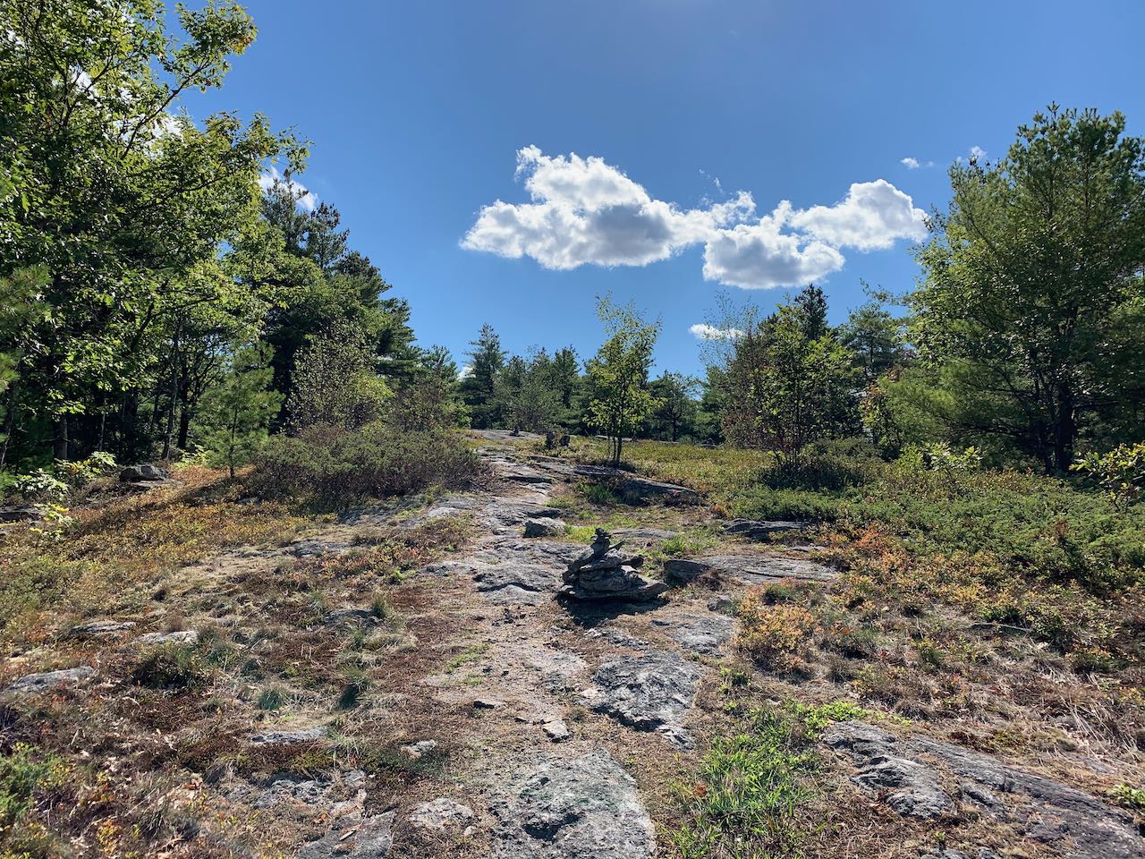
A cluster of three mountains stands mostly alone just over ten miles east of Concord. McCoy, Fort, and Nottingham Mountains are a mini-range recognizeable from far away. Fort is the highest point in a 16-mile radius, while just over the town line into Deerfield, Nottingham is the highest point in Rockingham County. None of the three major summits have developed hiking trails, but a shoulder of Nottingham Mountain known as Neville Peak is within the bounds of the Epsom Town Forest, where a network of walking trails includes a loop over its blueberry-covered summit. Open ledges provide nice views for your effort.
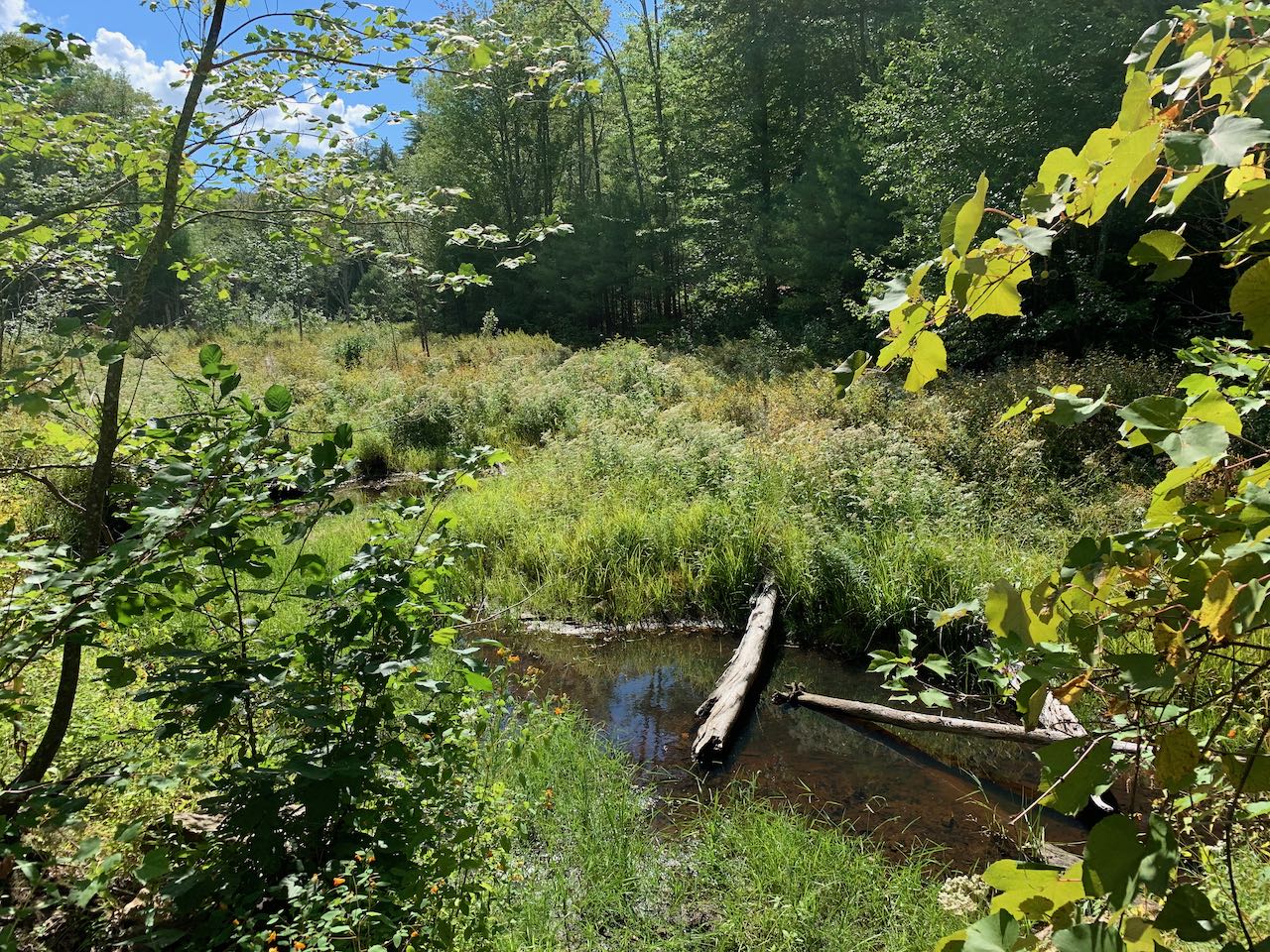
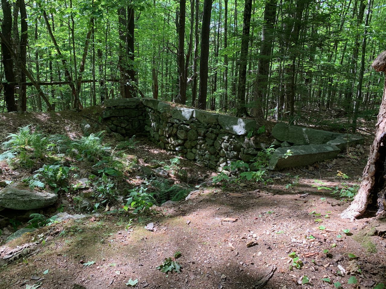
From the parking area, continue on foot down the ATV-grade Tarleton Road, dipping to cross through a swamp at 0.15 miles, and plod uphill for another quarter mile to a homestead site, where a stone-wrapped cellar hole remains on the right side of the road. Check this out for a moment, then take the left turn onto a footpath called the Neville Ridge Trail. This trail starts with a brief climb, then levels off through an open forest with a high canopy. It follows a dry brook, passes some embedded ledges, then descends slightly to cross a brook on a wooden bridge after half a mile. The trail climbs up the bank and skirts around a little knoll in the forest and drops into a small hollow in 0.15 miles. A moderate climb resumes, and the trail weaves its way up to a shoulder of the mountain, where it makes a sweeping 180-degree bend across a blueberry-filled plateau. In another 0.3 miles, the trail ascends once more, and emerges in the broad clearing around the summit, reaching the far end where the viewpoint is found after 0.15 miles.
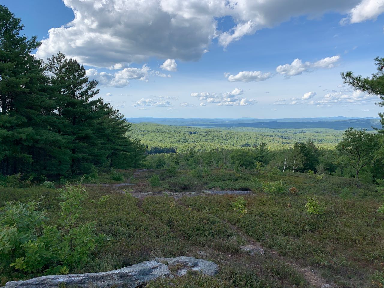
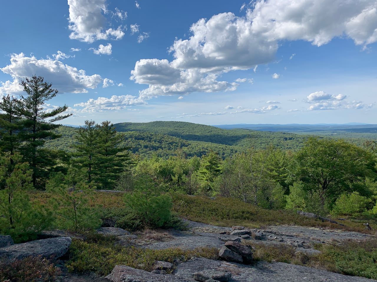
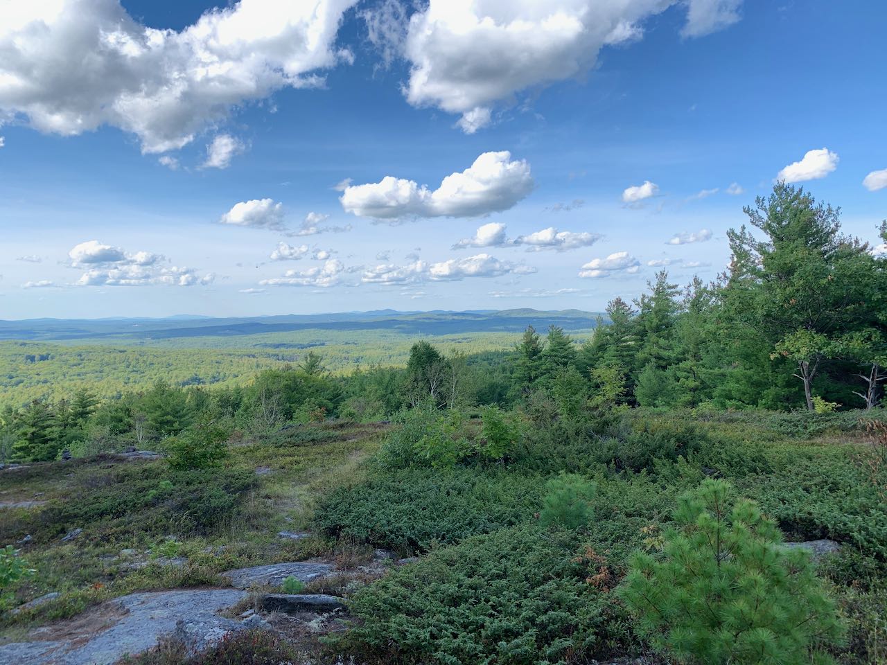
The view is seen over a wide strip of cleared ledges with a blueberry patchwork. Despite being low in elevation, the view is far-reaching. Out across the flat plains of south-central NH, many distant summits can be seen. A prominent feature over low ridges to the left is Mt. Cardigan, while in the center of the view, Mt. Moosilauke seems to stand alone. More to the right, some of the central White Mountains can be seen afar beyond the Belknap Range. On the far right are the two forested summits of nearby Catamount Mountain. If you walk downward a bit toward the view, you will also be able to look further to the left and see Fort and McCoy Mountains. To descend, follow the path, now making use of an ATV trail, across the opposite side of the summit area back into the woods. In 0.1 miles, stay right as a less-used track veers left for the summit of Nottingham Mountain. The trail descends a steeper side of the mountain with a few rocky turns for a quarter mile, then swings to the right and rolls straight across the hillside for three quarters of a mile back to the junction with Neville Ridge Trail. Proceed straight ahead the way you came back to the trailhead.
Printable directions page